Using satellite images to assess damages to heritage sites in Iraq
The challenge
Iraqi cultural heritage sites have suffered greatly from military activities, organised looting, illegal excavations and trafficking of cultural objects across the Country.
The entire world witnessed with astonishment the destruction of irreplaceable cultural treasures and the United Nations General Assembly adopted two resolutions on Saving the Cultural Heritage of Iraq in 2015.
In the same year, the discovery on ISIL’s Syrian compound of 700 ancient artefacts raised some doubts on the authenticity of the destructions claimed by ISIL. Some doubted that the monuments and artefacts destroyed were copies and not the originals, which were instead traded on the illegal market to fund the activities of ISIL.
The European Union Satellite Centre
The European Union Satellite Centre (SatCen) is an official Agency of the European Union, providing geo-intelligence products and services resulting from the exploitation of space assets and collateral data to support the decision making and actions of the EU in the field of Common Foreign and Security Policy (CFSP).
The satellite solution
In February 2018, the SatCen received a request from the EU Counter-Terrorism Office & PRISM (Prevention of Conflict, Rule of Law, Integrated Approach, Stabilisation and Mediation) to verify and assess the damage to cultural heritage in some of the urban areas controlled by ISIL in Iraq.
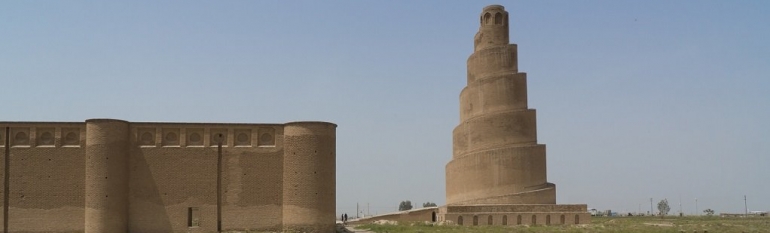
The resulting information was aimed to fight looting of Iraqi cultural heritage, to support the EU Advisory Mission on the Security Sector Reform in Iraq, and help archaeologists continue their work in these areas. These included the Balkuwara Palace area of Samarra, the ruins of the ancient city of Nimroud, the elevated mound of Tepe Gawra, the remains of the ancient city of Ninive, the Mosque of Nabis Yunes, and the remains of the ancient city of Dur Sharrukin (today Khorsabad).
The Centre analysed 117 satellite images of these sites in Iraq, in search of any damage or evidence of looting.
By comparing satellite images taken before, during and after the occupation, SatCen was able to verify and analyse the destruction of several antique buildings and classify the identified damage in three categories: possible looting (illegal excavation and plundering of an archaeological site for gaining profit, i.e. selling), fundamentalist damage (linked with the presence of ISIL in the area), and military damage (such as defence positions, revetments or trenches within archaeological sites).
The results
The use of satellite imagery has helped to verify, detect and classify in detail the damages sustained over time. A wide range of stakeholders, from local authorities to archaeologists, have been invited to use the data and complement it with their own, in order to fight illegal looting and help the reconstruction and preservation processes within the damaged areas.