Good City Life: crowdsourcing satellite data and emotions to map our urban landscape
The team
Daniele Quercia and Luca Maria Aiello, researchers at Nokia Bell Labs in Cambridge, and Rossano Schifanella, Professor at the University of Turin, started their scientific cooperation in the field of urban informatics in 2014. This partnership was to bring on “happy maps”: a project looking at what type of information or data would make city life more enjoyable for dwellers. The success of their initial project, determined them to expand it to a bigger platform.
Good City Life thus collects several sensory mapping projects with the goal of improving the quality of life in urban areas.
The challenges
Today satellite navigation data, such as GPS, is enabling us to better manage our time and perform tasks more efficiently. The most classic example could be seen in the numerous apps that help citizens find the shortest and easiest way to get from A to B, avoiding more complicated routes. Nevertheless, efficiency does not always correspond to quality and gaining extra time does not mean improving our everyday life.
The satellite solution
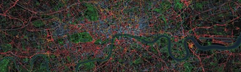
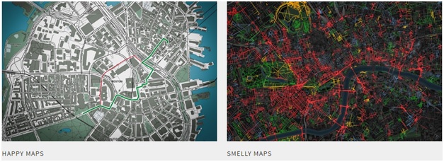
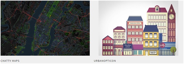
For this reason the team of researchers decided to create a service which provides citizens with tailored routes. As our senses play an important role in how we perceive our environment, the team went on to analyse the relation between our environment and our emotions. Crowd sourced data, geo-tagged social media pictures and open street map were thus merged. Based on the collected data the team moved on to provide cities with three types of maps: “Happy”, “Smelly” and “Chatty”.
The results
Using the geo tagged photos, the “Happy Map” inventories the city’s most pleasant spots and provides users with the happiest route to follow to their destination. The “Smelly one”, computes social media tags to capture an entire urban smellscape. Last but not least, the “Chatty map”, creates routes according to the city’s sounds.Depending on their interest, users can thus choose to get more out of their daily travelling experience rather than just getting from A to B.
The Good City Life platform is now available for around 12 cities in Europe and the US. If from the scientific point of view the value of this service is the capacity to quantify sensorial quality data, the relevance of this innovative mapping project lies in the opportunity to use the maps for land-use applications and services, as well as for urban planning and environmental health.