Flanders: improving traffic lights control with the support of satellite navigation
The region
The Flemish Region, commonly referred to as Flanders, is one of the three official Belgian regions, covering an area of approximately 13 000 km2.
The Flemish Agency for Roads and Traffic is the entity in charge of managing and maintaining the road network in the region, including 6 970 km of regional roads and motorways and approximately 6 700 km of bicycle paths.
The challenge
Among other tasks, the Agency is responsible for ensuring the correct functioning of the traffic lights installed on regional roads, and to control them so that priority is given to the public trams and buses of the Flemish transport company De Lijn (The Line). Until recently, such priority was granted by a system of loops placed on the street pavement at about 300-500 m from the traffic lights, and connected to them by electric cables. When a tram passed by a loop, a signal was sent to the traffic light through the electric cable, and a green light priority was given to the public vehicle.
In spite of its efficiency, this system presented a number of disadvantages: the loops were very fragile, and when they broke they disturbed the operation of the priority system. Moreover, they were fixed to the street pavement and their position could only be changed through infrastructural works that would disturb traffic. Hence, both their fixity and brittleness made the loops rather expensive to maintain, which prompted the Flemish Agency for Roads and Traffic to look for alternative solutions to regulate street lights.
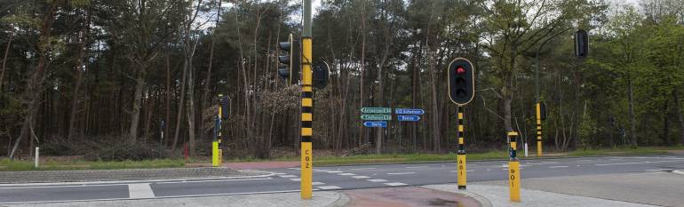
The satellite solution
The solution was provided by a system allowing to connect vehicles to traffic lights through satellite navigation and short range radio. After testing the system on one tram and five traffic lights, the Agency decided to extend it to the whole coastal tramway, which includes 58 crossroads with traffic lights and 48 trams (plus 20 extra trams during the summer season).
Every coastal tram is now equipped with a GPS and a radio transmitter, connecting the vehicles to control cabins which have been placed at each crossroad and are also equipped with GPRS devices. As a tram approaches a crossroad (detected through the GPS connection), it starts sending signals to the control cabin. Such signals, or “messages”, contain information on the tram number, line and itinerary and they are repeated until the tram has passed the crossroad. Based on such messages, the control cabin is able to give a green light priority to the tram, also taking into account waiting times for other road users. When the tram has passed the traffic light, a last message is sent to the traffic control cabin.
The result
The new system allows to control traffic lights and to give priority to public trams with considerable savings both in terms of money and human resources. Since the loops detecting trams approaching are now “virtual”, they can easily be moved and maintained with no need for infrastructural works. Moreover, while the previous system allowed trams to send only two messages to the control cabin, vehicles remain now in contact with the traffic light until they passed the light, hence increasing precision and reliability in traffic control.
“Not only the new system has financial advantages both in terms of investments and maintenance, but it is also more reliable in giving green light to trams, since it permits a precise monitoring of the position of the vehicles and of the times to pass traffic lights” Ethel Claeyssens, Director-engineer for routes, Flemish Agency for Roads and Traffic.
![]()