The Greek Ministry of Environment uses real time satellite data to detect fires
The Directorate
The General Directorate for the Development and Protection of Forests and Rural Environment of the Greek Ministry of Environment, Energy and Climate Change is the central competent body for the protection of forests and public lands.
Within the DG, the Directorate of Planning and Forest Policy is responsible, among other tasks, for planning and implementing forest-related policies in compliance with Greek and EU legislation, notably fire intervention and mitigation. Approximately 30 people are responsible for fire monitoring and restoration measures, in collaboration with some 1,500 staff of the national Regional Forest Services. Currently, the DG does not employ experts in satellite-based applications.
The challenge
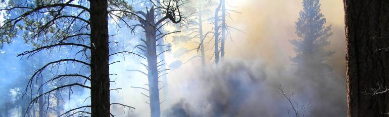
Greece mostly mountainous relief is covered with wide expanses of forests, some in remote areas. Droughts, high winds, and the sprawl of land development in the proximity of forests cause several wildfires every year.
Early detection is paramount for the Fire Brigades to limit damages to both the environment and human assets. Until recently, early fire detection was carried out by aircrafts surveying sensitive areas. Fire alerts were communicated by the pilots to the Fire Services, who would then send brigades on the spot. Manned flight monitoring over large expanses is very costly and time-consuming. Furthermore, it is only partially effective, since it implies a certain delay in the interventions, especially when fires start in neighbouring countries.
The satellite solution
The DG for the Development and Protection of Forests is among the first users of the FireHub service, developed by the National Observatory of Athens (NOA) within the BEYOND initiative, aiming at building a centre of excellence for Earth observation-based monitoring of natural disasters in South-Eastern Europe. FireHub is a fire early-warning service which relies on meteorological information, Earth observation data and other geospatial information.
Since 2013, the DG receives near-real time satellite images allowing it to monitor the fire extent in real time (fire monitoring data are produced every five minutes) and to forecast the smoke dispersion 15 minutes ahead. Through a dedicated web-GIS application, the service also provides information on fires that occurred in Greece during the last 30 years and generates burnt scar maps during and after wildfires.
The results
FireHub provides the DG and the Fire Brigades with timely fire detection data, enabling them to get a Situation Awareness Picture and to effectively deploy available resources. Moreover, FireHub maps burnt areas for damage and deforestation assessment. The maps are used by the DG to implement relief activities, to estimate carbon balance, monitor fire and soil erosion risk, and to plan urban developments.
The basic FireHub, free of charge, is particularly useful in case of fires originating outside Greek borders. Recently, a fire that started in Albania close to the Greek border was not officially notified to Greek authorities. The accident was instead detected via FireHub, allowing the Fire Brigades to intervene even before the fire entered the Greek territory.
The DG is currently working with the FireHub team to enhance the service, to hasten the damage assessment process and to identify reforestation areas within two months after the end of the fire season, in line with Greek legislation.
FireHub is a very useful tool that helps us with early detection of fires, thus hastening significantly intervention and restoration activities. Tryfon Daskalakis, Head of Directorate of Programming & Forest Policy, Ministry of Environment, Energy & Climate Change.
![]()