Integrated management system for the Danube Delta
The Danube Delta Biosphere Authority
The Danube joins the Black sea in the South-East of Romania, where it forms the second largest delta in Europe. This delta is also the largest continuous marshland on the continent, and includes the greatest stretch of reedbeds in the world. It was recognised as a UNESCO World Heritage site in 1991 and as the largest Ramsar wetland of international importance, especially as waterfowl habitat . The Danube Delta is a natural genetic bank of incalculable value for the global natural heritage. The Danube Delta Biosphere Reserve Authority (DDBRA) was created in 1990 as a public agency in charge of the administration, protection and conservation of the natural reserve.
The challenge
The main challenge for the Danube Delta Biosphere Authority is keeping the fine balance between preservation and exploitation. The Delta is a biodiversity haven, with 300 species of birds as well as 45 of freshwater fish over a complex ecosystem of next to 600 hectares. But, at the same time, it is an area of significant economic potential thanks to tourism, fishing and reed harvesting. As an example of such potential conflicts, reed exports for luxury roofs are a significant source of revenue, while reed beds are also habitats for various species of insects, fish and vertebrates. Reconciling the two requires a fine and up-to-date knowledge of the evolution of habitats with regard to human activities and other sources of pressure, like climate change. The information the Authority disposed of was scattered in various paper records and manually entered after field visits. This made the follow-up of the situation on the field cumbersome, and not fully reliable.
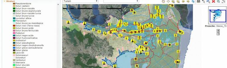
The satellite solution
In 2009, the Authority applied for EU environment funds and co-funded an integrated geo-information system (GIS) for managing and monitoring the reserve. The GIS relied land cover information derived from SPOT satellite high-resolution multispectral images which gave the opportunity to analyse and study the vegetation and biomass and to have a complete pictures of the area at a specific time. Further information layers were included such as the strategic points of interest (reed harvest areas, fishing boat access sites and shore fishing sites, tourist accommodations, historic sites. Moreover, the GIS included detailed layers of habitats and species distribution, as well as the Natura 2000 sites.
Furthermore, the staff documenting many of the inventoried parameters (including finer levels of information such as water quality), were endowed with palmtop computers to digitally record their data in the field, and to geolocate it thanks to GPS. The collected data is then synchronised with the local database.
The result
The Authority now disposes of an unprecedented digital record of the Delta status which is constantly updated with fresh data from the field and other sources. Thanks to the different layers of information available in an integrated GIS system, the Authority can simultaneously compare the various relevant parameters to be considered, for instance, when deciding on a building permit. By not having to manually enter their observations by writing them on paper records, staff saves time which they can dedicate to other tasks.
The Danube Delta Biosphere Authority uses the system for both decision-making and to fulfil its national and European reporting obligations – such as those entailed by the Natura 2000 status of the area. The two years since the GIS has been operational have been too short a period to draw conclusions on the evolution of the habitats, but for the first time in the many decades it will be possible to monitor the Delta with precise and up-to-date information and to hold on to its status of the best preserved delta in Europe.
“Having an integrated monitoring system, available both in the office and outdoors, makes our job easier and less time-consuming. It has completely changed our approach to managing the Delta.” Camelia Caprita, Danube Delta Biosphere Reserve Authority
[1] http://whc.unesco.org/en/list/588/
[2] http://www.ddbra.ro/en/danube-delta-biosphere-reserve/danube-delta