FATMAP: Changing outdoor mapping by combining satellite technology and local expertise
The Start-up
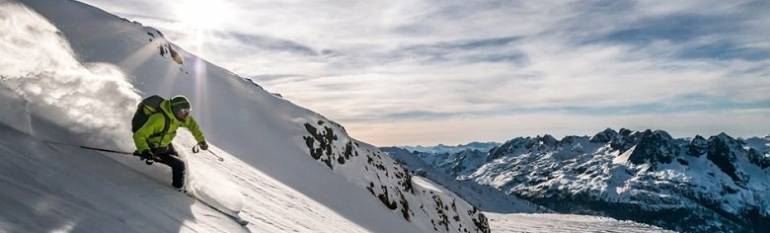
Based in London, FATMAP was founded in 2013 by mountain enthusiasts David Cowell and Misha Gopaul. The company is developing a map platform designed to solve the unique problems that are inherent to outdoor navigation. The first application of the technology, FATMAP Ski, provides its customers with ultra-high resolution ski maps on mobile, desktop and other connected devices with full offline use. The app currently covers over 40 popular locations in five European countries, the US and Canada.
The opportunity
With a 110 million skiers around the world in more than 70 countries, the snow sports market is huge. Snow sports totalled $4.5 billion in sales for the 2014/2015 season[1] while the outdoor recreation market, as a whole, was estimated at $646 billion. And these numbers represent the US market alone. For many outdoor sports lovers, maps are among their top five most popular purchases. Their accuracy is crucial, especially in remote areas where one cannot rely on GPS connectivity and power sources.
It was after getting lost in Albania’s highest mountain peak, Maja Jezercë, that FATMAP founders came to a valuable conclusion: topographic maps are outdated. They are often static, slow, lack context and, most importantly, they are missing local knowledge. For some locations, maps are not even available, are not accurate enough or up to date.
The satellite solution
To provide its users with a 1:1 high resolution real world view, the team used game engine technology combined with high-resolution, 40cm- 50cm satellite imagery and sub-2m digital elevation models (DEMs) of mountainous areas. The FATMAP platform is able to take this data and calculate crucial terrain and safety information, such as gradient, aspect and even avalanche risk, on the fly. It’s community of mountain professionals continuously add expert route and area content making them a valuable resource for anyone exploring the mountains. The company also plans to introduce high precision weather data, dynamic sensor data and other integrations. Because mobile connectivity can be limited in remote areas, maps can also be downloaded and used offline. The app also allows users to keep track of their records through GPS and share them with friends.
The result
The app and its numerous features took three years of development. The first pilot was launched in 2015 in three European resorts, hitting 2,000 users in their first weekend and 10,000 users in the following 6 weeks. Once launched in January 2016, the app reached more than 120,000 users in 15 weeks, covering 35 major skiing resorts. FATMAP are busy expanding the platform to global coverage of outdoor areas by 2017. And that is not all. This summer they are diversifying their offer by launching their first summer maps for hiking and biking.
The imagery from Digital Globe’s WV3 satellite has made it possible to produce terrain models and ortho-imagery at such high resolution that the boundaries between mapping and virtual reality are blurring. Showing the world as it is in real-life, together with up-to-date reference data completely transforms people’s ability to understand terrain in the outdoors.
Misha Gopaul, Founder & CEO
[1] http://www.snowsports.org/research-surveys/snow-sports-fact-sheet