City of Potsdam: Monitoring environmental sustainability
The city
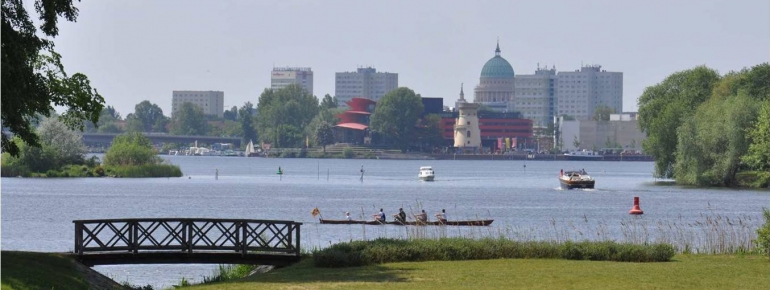
Potsdam is the capital city of the German federal state of Brandenburg and home to over 155.000 inhabitants and UNESCO – world heritage site. Bordering on Berlin, the city is part of the metropolitan region Berlin-Brandenburg that is characterised by highly urbanised areas (Berlin and Potsdam) surrounded by rural, natural landscapes.
The challenge
The city attaches great importance to the reconciliation of urbanisation and the respect for natural habitats, and ecological sustainability is an important factor in the formulation of the city’s public policies.
However, the city officials considered the environmental monitoring information provided at regional level insufficiently detailed. The city administration therefore provided a budget and mandated its Department for Environmental Monitoring to survey the evolution of natural habitats (biotopes), the volume of the city’s vegetation that contributes to maintaining air quality (green volume), and the loss of soil to the construction of roads and buildings (soil sealing).
For this mission, a source of information needed to be identified that was readily available, easily comparable at regular intervals and at a reasonable cost.
The satellite solution
Satellite images proved to be the most appropriate solution for the Department’s need for information on a relatively small area at a precise point in time: the city’s territory is covered by a single image which can be purchased when needed at low cost.
The satellite images are interpreted by an external service provider who extracts the information regarding natural habitats, green volume and soil sealing. The Department for Environmental Monitoring then feeds this information into the city administration’s Geographical Information System, combining it with information from other sources (archive aerial images, habitat maps, topographic maps, statistical data, etc.).
The result
The results of this regular, in-depth analysis are available as a basis for the city council’s public debates on sustainability, providing tangible information that allows public policies to target issues touching on the city’s ecological balance. For example, in expanding neighbourhoods where the balance between urbanisation and the respect of green spaces and natural habitats may be threatened, the city council can react by adapting urban planning.
The information, illustrated by satellite images, also serves as an important tool in the city’s public relation activities to demonstrate its performance in terms of sustainability.
“Without the use of high resolution satellite images to measure soil sealing and green volume, effective environmental monitoring at municipal level with data available elsewhere would have been difficult to achieve otherwise.” Steffen Tervooren