Arno River Basin Authority: monitoring of hydro-geological phenomena using satellite imagery
The Arno River Basin Authority
The Arno is the second most important river in Central Italy. The Arno River Basin Authority is in charge of safeguarding and valorising the soil, and of ensuring the correct use of the water resource in the basin, covering a densely populated area of about 9 131 km2.
The challenge
The Arno basin is rich in superficial and underground water resources, intensively exploited in the past for drinking and industrial uses. Soil deformation and landslides are usual phenomena in the region: more than 2 500 areas are at high risk of landslides and more than 600 landslides have been mapped between March and April 2013 only.
The Basin Authority is responsible for annually updating the Inventory of Landslides in Italy (IFFI) for the Tuscany Region and for using it to implement the Basin Plan, including a description of water-related risks, water quality, excavations, and the actions planned to reduce hydro-geological risks. To perform its tasks, the Basin Authority needs uniform information about water and soil that can be compared over time.
“To reach a common understanding (…) of soil degradation processes, it is important to ensure data comparability”. Soil Thematic Strategy COM(2006)231
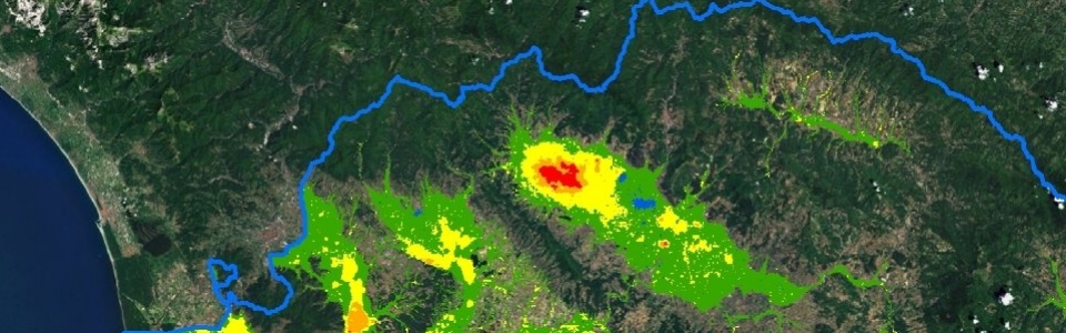
The satellite solution
In 2005, when the IFFI was first built, the Basin Authority benefited from the ESA-funded project SLAM (Service for Landslide Monitoring). More than 350 satellite images were combined with ground information to assess slope instability and risk across 8 830 km². 27 000 landslides were identified and 10 000 of them were classified as active.
Since the end of the project, satellite data has been used to update the IFFI and to implement the Plan of the Arno Basin.
The result
Information collected through satellite imagery permits to have a uniform overview of the entire area, to monitor subsidence, landslides and building stability and to plan interventions in the areas exposed to major risk.
As part of the Plan’s implementation, satellite imagery has been employed to assess the soil deformation between 1992 and 2007 with millimetre-accuracy. The deformation maps produced are also used to verify the correlation between subsidence and human activities. For example, in the Prato alluvial plain, an area historically affected by subsidence, it has been possible to verify that the decrease in the demand of industrial water has caused a lift of the soil and a rise of the water table.
“Satellite imagery allows to monitor changes of hydro-geological phenomena spatially and throughout time, thus allowing to concentrate the restoration effort where it is more needed.” Giovanni Montini, Arno River Basin Authority